It’s late September. Summer, or what’s passed for summer in the UK this year, is morphing slowly into autumn, students have returned to their studies and the seasons turn again.
I’ve made some wonderful mudlarking finds since my last blog – a Thames thimble, a Victorian-era halfpenny inkwell, another 15th/16th century Pinner’s bone AND my first ever Roman coin! – and life has been busy. But I’ve decided to save writing about these finds for the next blog and to write about something else this time, something very dear to my heart. The Thames Path.
‘Solvitur Ambulando’ is a phrase I learnt during Latin lessons at school. Loosely translated it means ‘it is solved by walking’. Often attributed to dear St Augustine though like so many famous sayings no one quite knows who actually said it first. But it’s long been known and championed that walking is a wonderful thing to do – good for both our physical and mental health.
All of which segues neatly into writing about The Thames Path, and I’ve spent quite a bit of time walking various stretches of it this month too.
Stretching for approximately 185 miles in total, the Thames Path follows the greatest river in the world from source to sea, past bucolic water meadows, picturesque rural villages and historical towns and cities. There are many different routes you can take, both long and short, according to taste, level of fitness and how far you want to walk. There is an excellent Thames Path/National Trail website with lot of information and advice if you’re planning a walking route:
https://www.nationaltrail.co.uk/en_GB/trails/thames-path/
The idea for Thames Path walks was first proposed in 1948 though they weren’t officially opened as walking routes until 1996. The route this blog is focusing on is a fairly short one, all things considered, from London Bridge to Rotherhithe, walking in a downstream (easterly) direction along the river.

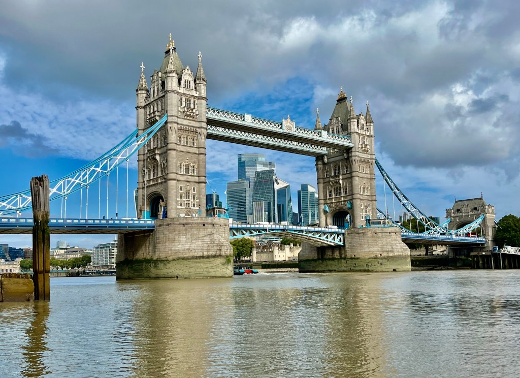
As you exit London Bridge station, cross the road and turn right along Tooley Street, then left along More London Place. You’re never far from the river in this location and you’ll see it re-appear as you approach City Hall and Potters Field Park. Tower Bridge looms straight in front of you.
On the rather grey September morning when I walked this particular stretch of the Thames Path, Potters Field Park was a riot of colour. A group of Bollywood actors and dancers had taken over and were practising their moves, barefoot, on the grass. It was lovely to see. After a chat and some photos I waved them goodbye and walked on.
Continuing southside under Tower Bridge Shad Thames appears in front of you, The Anchor Brewhouse on your left. In 1787 Scotsman John Courage bought a small brewhouse on this very site. A year later, records state that he’d managed ‘to brew 51 barrels of beer at the Anchor Brewhouse, Horselydown’. The building was later expanded to include a boiler house and malt mill in addition to the brewery itself. The current building dates from 1871, largely rebuilt in 1894-1895. Later restoration work took place during the 1985 -1989 redevelopment of this area and the building is now Grade II listed.

As a side note, while writing this blog I got majorly distracted by my research into the history of brewing in Southwark, which is long and distinguished, its roots going back to the early Medieval period. The landscape then was very different with many small streams, in addition to the Thames itself, providing one of the essential ingredients for this industry – water. Both Chaucer and Shakespeare have at different times mentioned the brewers of Southwark in their writings.
Women dominated the brewing industry throughout England from about 1300-1500, after which the patriarchy essentially flexed its muscles and pushed them out. The reasons for this are both obvious and complex though, in a nutshell, men became increasingly insistent that more traditional gender roles should be adhered to by women, especially once the Reformation had swept through much of Northern and Central Europe, leaving them vulnerable to charges of ‘crimes’ such as witchcraft, with its inevitable trials and punishable by death, if they upset the status quo. It was instead preferred they should stay at home busying themselves with domesticity and raising children.
The history of medieval brewing has given me a fresh insight into women and business in the Middle Ages which, for all its difficulties, allowed them a measure of financial independence and freedom, particularly for those who were unmarried, to pursue a way of life that gave them some degree of agency. It’s unfortunate that we will never known their names because amid the chaos of life in Medieval Southwark, unlike north of the river, there was little in the way of record keeping.
It isn’t perhaps as widely known as it should be that from Ancient Egyptian times onwards the very first brewers were women. They brewed for religious ceremonies and to make a practical, protein and carbohydrate-rich drink for the home at a time when working class people could not afford wine, and river water wasn’t clean or safe enough to drink on its own. Plus ça change…
And it was women who brewed and sold most of the ale in Southwark , indeed in much of Medieval England. They produced and sold ale from home (ie ‘home’ was often just one small room shared with others), or going to market to sell their brew from cauldrons. Southwark, south side of the river, did not have the regulatory controls of the City of London and Guilds on the north side of the Thames, so women were free to produce and sell as they wished, earning money and enjoying a measure of financial independence and control thanks to their knowledge of fermentation, often passed down the female line of the family.
In fact, the word ‘Brewster’ means a female brewer. The first mention of women’s involvement in this trade in Southwark appears in about 1200. At that time brewing meant producing ‘ale’ – a drink made from fermented yeast, malted grain and water. If you had access to water you could make ale. It was sweet tasting and popular, widely consumed, but unstable and spoiled quickly. It also couldn’t, for obvious reasons, be produced in large quantities.
The introduction of hops and changes in farming practices in the 16th century precipitated widespread changes in the brewing industry, another reason why women began to be squeezed out.
Inevitably by 1600, most brewers in London were male. The use of hops in brewing switched the focus from ale to beer and made the product more bitter but also created something more resilient. Making beer conferred social prestige on the (male) brewers who had the money to invest in equipment thus beginning the industrialisation of brewing. Financially, logistically and socially women could not compete with this and it meant they were effectively pushed out of the brewing process.
So, when you look up at the Anchor Brewhouse spare a thought for the raucous playground that was medieval Southwark and pay silent homage to the women brewers who went before.
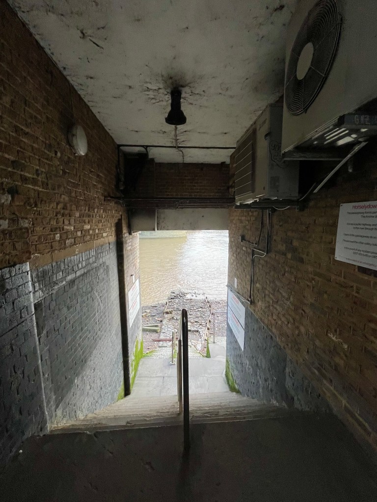

There are steps that take you through the Anchor Brewhouse onto the Thames Foreshore from which there are magnificent views of Tower Bridge. The Thames Foreshore is an open public space, though with some restrictions in certain places, and you are free to walk here. But I do urge extreme caution for anyone navigating these algae-covered river steps as they are old and eroding fast. On the day I took the above photo of Horselydown stairs, a tourist had slipped and fallen down them. She was a bit shaken but fortunately wasn’t seriously injured. A young German couple got chatting to me and told me that this location is advertised quite openly on TripAdvisor (which is where they’d learnt about it) but they didn’t recall it coming with health and safety warnings. So, if you are coming down here, please be careful and wear decent footwear. Cool photos of Tower Bridge on Instagram are no fun if you’ve ended upbreaking an ankle to get them.
The Port Of London Authority (PLA) who manage the Thames Foreshore have an excellent page with advice on visiting the Thames, including a free ‘Go Jauntly’ app which is useful to download:
https://pla.co.uk/visiting-thames
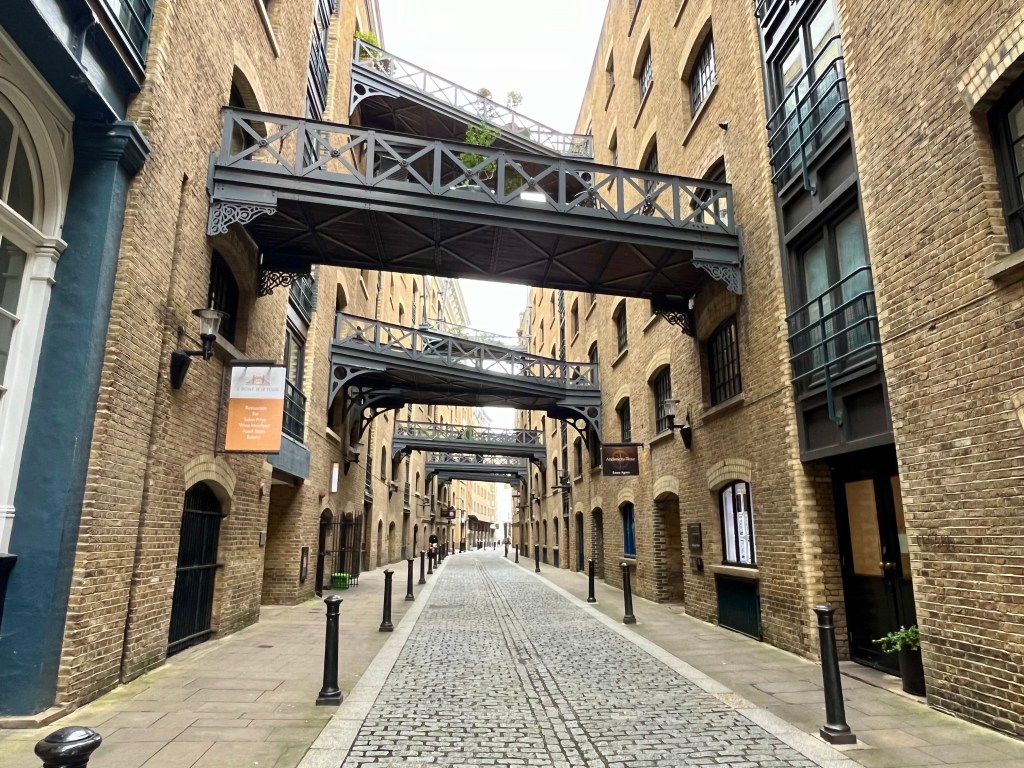
Re-emerging onto the pavement outside The Anchor Brewhouse you will find yourself back on Shad Thames, the name itself is a corruption of ‘St John at Thames.’ In the Victorian-era, when the Port of London was one of the busiest ports in the world with goods being loaded and unloaded from literally thousands of boats, barges and lighters, Shad Thames was known as the largest warehouse complex in the capital. Completed in 1873 these warehouses were home to huge quantities of coffee, tea, spices, dried fruit and all sorts of other commodities brought in from around the world. This led to the area being known as the ‘larder of London.’

Today Shad Thames has been re-developed into offices, luxury apartments and restaurants. But the history of this area remains in the very bones of the buildings. As you walk along you can still see the overhead gantries which connected the warehouses and, if you stop for a moment outside Cardamom Building (pictured above), close your eyes and imagine the scent of spices in the air.
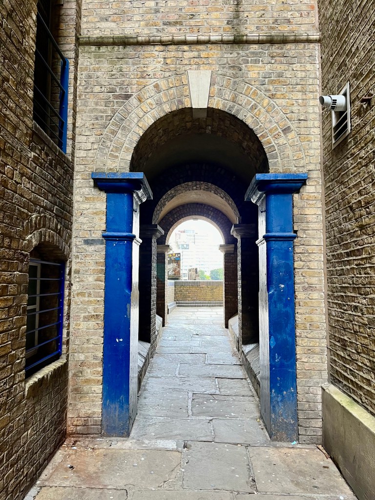
Opposite Cardamom Building there is a passageway that will take you back to the river and Butler’s Wharf. Shad Thames documents show that a grain trader by the name of Mr Butler rented wharehouses from the Thomas family in 1794, hence the name ‘Butler’s Wharf.’ Today the existing Butler’s Wharf has a public walkway which forms part of the Thames Path with excellent views of Tower Bridge upstream, St Katharine Docks directly opposite, and views of Rotherhithe and Canary Wharf downstream.
You’ll see Butler’s Wharf Pier as you walk towards New Concordia Wharf. Butler’s Wharf Pier is home to a fleet of private chartered boats owned, along with the pier itself, by the Livett family who have been working the Thames since 1710. The current director of the pier is Chris Livett, a seventh generation Thames Waterman and Waterman to King Charles III, having previously served in this capacity for the late Queen Elizabeth II.
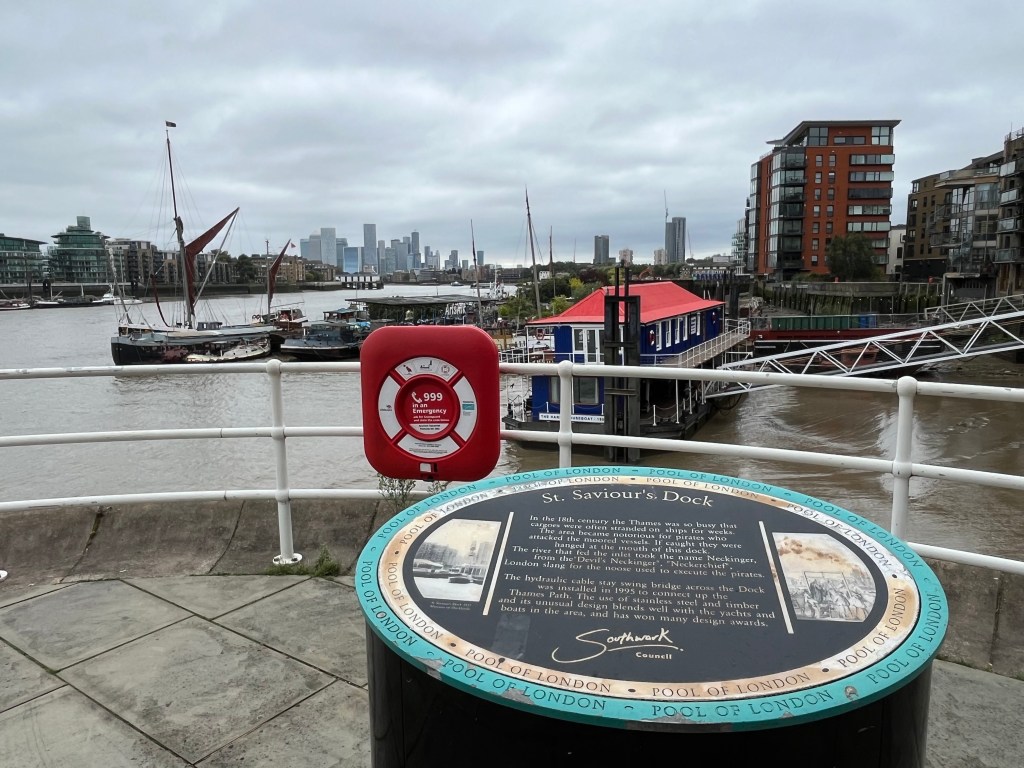
I always like to stop and take in the view at St Saviour’s Dock. To the right of my photo you’ll see an inlet which is where the River Neckinger, one of London’s subterranean rivers that rises south of Southwark, flows into the Thames. In the 18th century the Thames was so busy bringing in goods from all round the globe that cargoes were often stranded in the river for weeks on end. Indeed it’s been said you could walk across the Thames from south to north and back again by jumping from one vessel to another. The area became one of many in the Pool of London that was notorious for theft as pirates attacked the moored vessels to steal the goods.
This was one of the main reasons for the creation of the first proper police force in London, the Thames River Police, organised in 1798 by Scottish magistrate Patrick Colquhoun and master mariner John Harriott. Initially funded by merchants from the West India Company who were losing large amounts of cargo to theft and looting, the river police brought much needed law and order to the crime-ridden Thames. Eventually absorbed into London’s Metropolitan Police in 1839 after which they became known as Thames Division. They continue to exist today as the Marine Policing Unit (MPU) and are based at Wapping.
If pirates were caught looting vessels they would be hanged at the mouth of St Saviour’s Dock. The very name ‘Neckinger’, the underground river which reaches the Thames in this spot, is thought to be London slang for ‘Devil’s Neckerchief’, ie a reference to the noose used to execute pirates. I’ve walked this path on foggy winter days when there’s an eerie half-light and you can hear the creak of ancient timber from the wharves, wind whistling through the hydraulic cable of the stay swing bridge (installed in 1995 to connect the Thames Path.) It’s not too far-fetched to think you’ve stepped back into a very dark time when the bodies of criminals were left hanging from gibbets here.
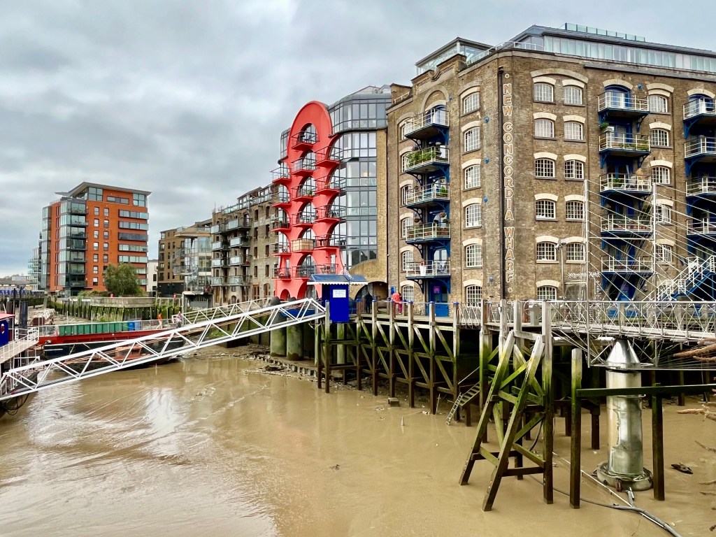

Just before you cross the swing bridge approaching New Concordia Wharf, you’ll see to your right what remains of the exteriors of Wheat Wharf, The Clove Building, Tea Trade Wharf, Saffron Wharf, Anise and Coriander Court Buildings – remnants of the Victorian spice warehouses, although this site also housed two corn-drying kilns.
Charles Dickens set ‘Oliver Twist’ in the area of Shad Thames and looking back at old photos you can see why. Once notorious for poverty, though the warehouse and ship owners made large fortunes from the import of goods stored here, it would have been dark, dirty, noisy and dangerous for local people, criminals lurking in the shadows. Bill Sikes meets a violent death in the mud of St Saviour’s Dock while Fagin’s Den was located in one of the Shad Thames warehouses.

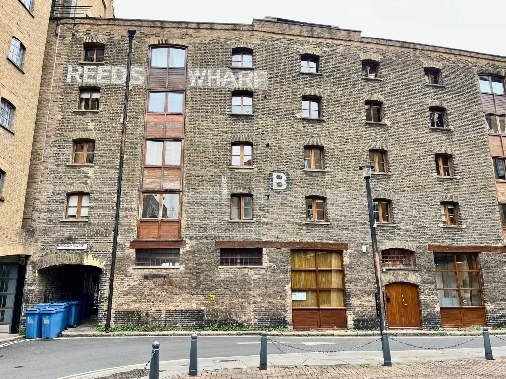
Continuing along the Thames Path, a striking red-walled passageway takes you briefly away from the river and into a courtyard that belonged to Reeds Wharf, a Grade II listed 19th century warehouse. There’s been a warehouse on this site since the 18th century but the current building dates from the 19th and was a granary once belonging to H. Reed, mainly handling grain from North America.
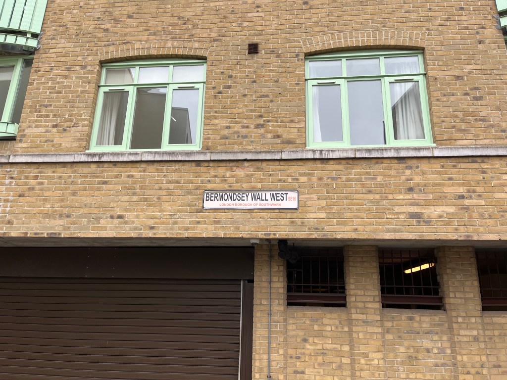
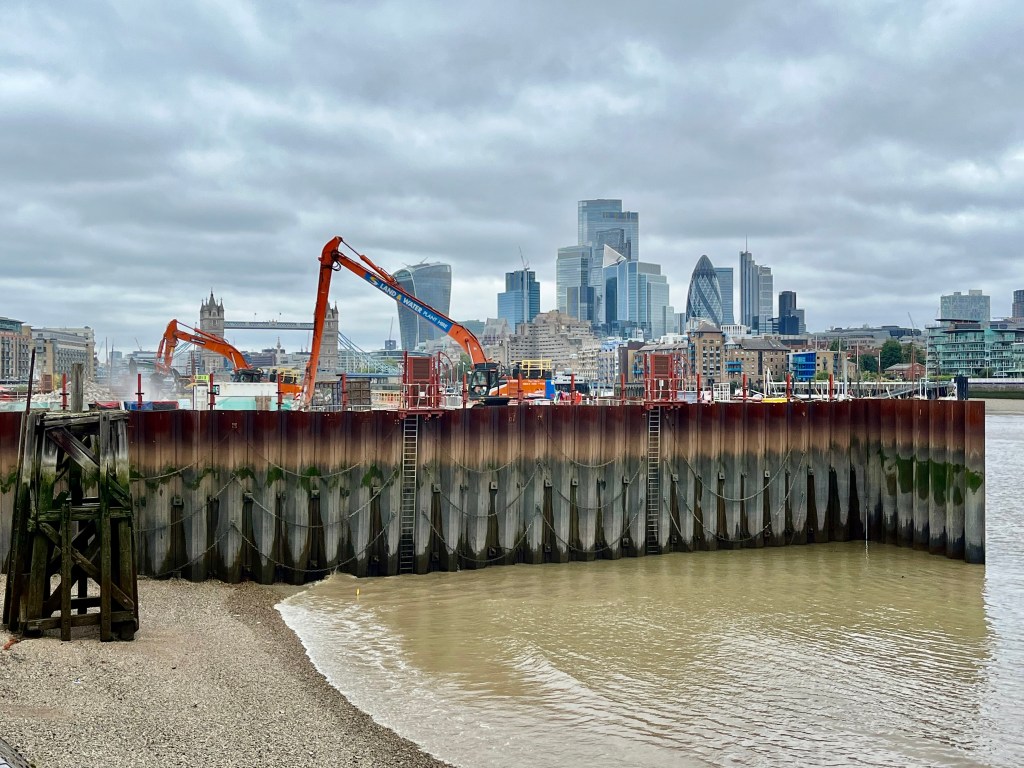
Then continue along Bermondsey Wall West following the well signposted Thames Path route which will bring you back to the river at Fountain Green Square, just past the location of the new super sewer at Chambers Wharf. This is Tideway’s main drive site where tunnelling first began in the Thames, one of the busiest and most important locations of the project. The work is very much ongoing here and this summer has seen Tideway beginning to remove the cofferdam, the temporary area of land built out into the river so that structures could be built below ground. The new super sewer will mean that instead of flowing into the river, almost all sewage overflows in the centre of London will be stored in the tunnel until it can be safely processed. The super sewer is expected to be fully operational in 2025, and not a moment too soon.
From this point at Chambers Wharf it’s now possible to complete the short walk down to Rotherhithe, past Cherry Garden pier, and the end of this part of the Thames Path. There are quite a few points of interest along the remainder of this route.

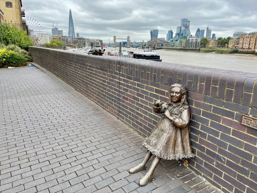

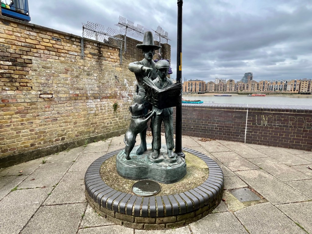
One of my favourite parts of this walk as Bermondsey merges into Rotherhithe is the group of riverside bronze statues in tribute to the Salter family – Ada, Alfred, their daughter Joyce and her cat. I’m not a fan of statues in general but I love these and, although tinged with sadness, they somehow always manage to bring a smile to my face. A contradiction, I know, but the statue of Joyce in particular is so full of life.
Ada and Alfred Salter transformed the lives of people in crime and disease-ridden Bermondsey, becoming much loved figures in their community. Alfred was a brilliant doctor with a social conscience who had trained at Guy’s Hospital and moved to Bermondsey at the beginning of the 20th century to work in this deprived area. He didn’t charge the patients he treated, promoting the idea of free health care well before the NHS formally did when it came into existence in 1948. Ada, a social worker, opened clubs which transformed the lives of Bermondsey’s toughest working girls and gave them hope along with a chance of a better future. Ada met Alfred in Bermondsey and they married in 1900, both joined the Independent Labour Party and devoted the rest of their lives to the poor of Bermondsey and Rotherhithe. Ada later became the first Labour woman councillor, eventually Mayor, in London. Alfred was elected MP for Bermondsey in 1922.
The lives of Ada and Alfred Salter were marred by tragedy in 1910 when Joyce, their only child, died of scarlet fever at the age of 8. A highly contagious illness that mostly affects children, today it’s easily treated with antibiotics. At the beginning of the 20th century however, there was no such medication, and in poverty stricken areas of large cities the disease spread quickly. The Salters never recovered from Joyce’s death and threw themselves into work.
Sculptor Diane Gorvin has called these beautifully forged statues ‘Dr Salter’s Daydream’. An elderly Alfred Salter sits by the river imagining his beloved wife Ada, much loved daughter Joyce with her cat, as they once were in happier days.

Just to the side of the tribute to the Salter family are the remains of King Edward III’s manor house. Edward III (Plantagenet) ruled from 1327-1377, famous for taking England into battle with the French during The Hundred Years’ War and annexing large parts of France for the English crown. He married Philippa of Hainault and they had fourteen children, one of whom is my favourite forgotten medieval teenage princess, Joan of England.
This Royal building, now a scheduled monument, was actually a moated manor house constructed in 1350 when Rotherhithe was a small hamlet set in low-lying marshland. The King would arrive by boat and moor the Royal barge at river steps that then led directly to a gatehouse.
It’s been said that the manor house may have been used as a hunting lodge but this is unlikely as there was no Royal Park nearby unless the hunting involved water fowl, which was perfectly possible. More likely it was used for the king to practice his falconry as there was a clear view of the birds across the flat marshlands and river.
By the 16th century this area had begun to change significantly in appearance with land being reclaimed and the Thames waterfront pushed northwards. A road was built along the new river embankment, eventually becoming what is now Bermondsey Wall. In the 18th century this site became the Rotherhithe Pottery and by the 19th century warehouses had been built on it, the final warehouse demolished in the 1970s. After archaeological excavations in the 1980s the area was restored to the vista we see today.
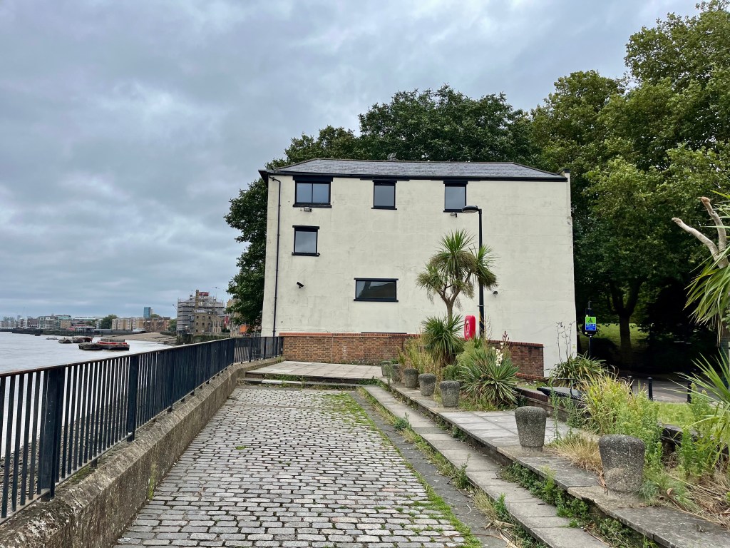
As you walk on, keep an eye out for the strange, solitary, cream building known locally as the ‘leaning tower of Rotherhithe’. It has a fascinating history. Recently sold by Savills it was once part of a row of buildings along the river, many of them destroyed or severely damaged by the Blitz.
Previously known as 41 Rotherhithe Street, now renamed 1 Fulford Street, the building was once owned by Victorian barge company Braithwaite and Dean, and used as an office where lightermen (who unloaded goods from flat bottomed barges) pulled up to collect their wages. In 1937-1939 it was home to Winston Churchill’s nephew, Esmond Romilly, and his wife Jessica Mitford. Noel Coward was a frequent visitor to this house as was Princess Margaret with photographer Anthony Armstrong-Jones, who she later married.
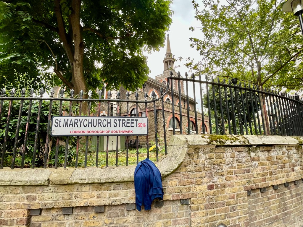
Once you’ve reached St Marychurch Street, it’s worth popping in to have a look at the churchyard and church of St Mary’s, if open. The present parish church (full name St Mary the Virgin with All Saints) dates from 1714-1716, though there’s been a church here since the 12th century. It has some very well known memorials incuding one marking the final resting place of Christopher Jones, captain of The Mayflower, which took the Pilgrim Fathers to America in 1620.
It is also the burial place of Prince Lee Boo of Palau, a Pacific Island Prince, and of Vice Admiral Sir Thomas Teddeman. There’s a lot of useful information about St Mary’s on their church website, click on the link below to learn more:
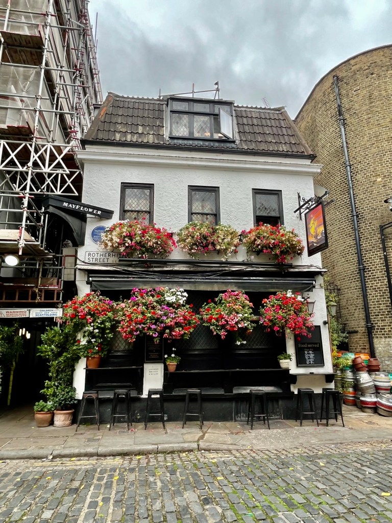
It usually takes me approximately an hour to walk to this point (avoiding the temptation to nip down to the foreshore to mudlark via whichever river steps I happen to be passing en route), though perhaps an hour and a half if strolling slowly and stopping to take photos and gaze out over the river. If you’re well and truly flagging by now, directly opposite the church is the famous Mayflower pub where you can stop for refreshment and then carry on to the Brunel Museum. Or terminate your walk here and make you way home via Rotherhithe Station. It’s your choice entirely and you can always come back another day.
The Mayflower’s history as a pub is deeply and predictably rooted in its location, an area rich in maritime history and trade. Goods would have been unloaded from the nearby wharves and lightermen, watermen and sailors from all around the world have caroused in the pubs and taverns here ever since the 17th century. Rotherhithe was also a busy centre for ship building and ship breaking.
The current building is not the original one from the 16th century and known as the Shippe Inn, later rebuilt and renamed The Spread-Eagle. War damage during the Blitz resulted in a major refurbishment in 1957, which will come as a shock to some readers, because it was only then that it was renamed The Mayflower. The architect responsible decided to recreate a 17th century interior which makes The Mayflower look much older than it really is. But a good story never dies and the pub still has strong connections with American visitors who can sign a ‘Descendants Book’, if they can prove their ancestors sailed from here on The Mayflower ship in 1620.
If the history of The Mayflower is of personal or historical interest to you, before leaving the area take a left turn as you exit The Mayflower pub and stroll for a few minutes along the Thames Path to Cumberland Wharf. This is the approximate site where the Pilgrim Fathers set sail for America (via Southampton and Plymouth to pick up supplies.) There is a bronze statue marking this event and its place in history.
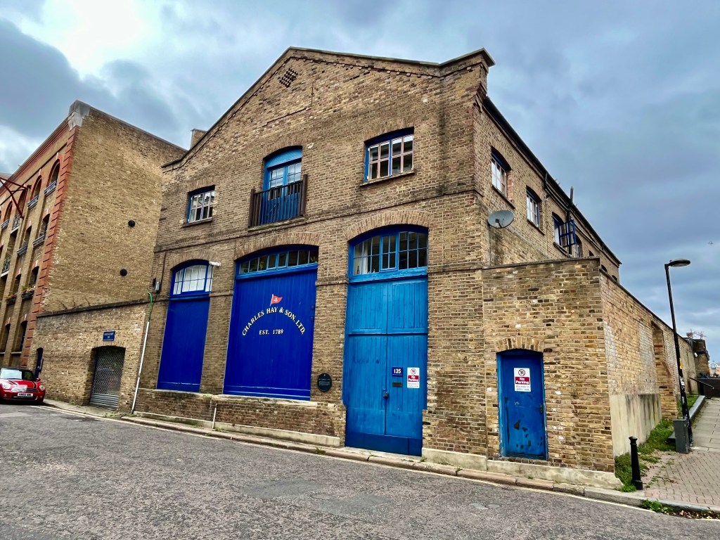
En route to the site of the departure of The Mayflower ship you’ll pass both the Brunel Museum and the sensitively restored building belonging to Charles Hay & Son, located at 135 Rotherhithe Street, who were successful barge and lighter builders. The striking royal blue paint of the doors and windows pops out from the brickwork and gives a real flavour of what this area must have once looked like.

Last but not least, the Brunel Museum in Railway Avenue is a fine small museum well worth visiting and of manageable size even if your energy has drained away by now. Run by volunteers, it tells the story of one of the world’s greatest engineering dynasties, French born Sir Marc Isambard Brunel and his son Sir Isambard Kingdom Brunel (named after his English mother Sophia Kingdom.) Check the museum’s website for opening times.
Today the Thames is both recognisable in parts, unrecognisable in others. The London Docklands Development Corporation, set up in 1981 by Margaret Thatcher’s Environment Secretary, Michael Heseltine, who granted permission for massive redevelopment to begin on both sides of the Thames in the mid 1980s, shaped the vista we see today. There was considerable opposition to the initial plans as locals feared buildings being turned into luxury apartments, and old communities pushed to the margins. Much of this came to pass and it’s difficult not to feel sympathy with those whose families had lived here for generations. But even now when walking this stretch of the Thames Path I can still hear old Bermondsey voices in the air, so the spirit and identity of the original residents is very much alive and well in places.
And something tangible still remains of the old city port, the noisy brutal smoky London of commerce and enterprise.
The Thames Path tells the story of London – its trade, its industry, its ever-changing population, its immigration, survival and regeneration. So get walking, and absorb yourself in the history of the greatest city in the world.

While I was reading I felt like you took me by the hand and I walked alongside the river with you. Thanks for the experience!
LikeLiked by 1 person
You’re very kind, thank you. I hope you can do this river walk in person one day. It’s one of my favourites.
LikeLike